This year’s relentless hurricane season has seen another significant development. Tropical Storm Sara, the 18th named storm of the season, formed over the Caribbean last week. While Sara initially showed potential to strengthen into a hurricane, the system has since weakened and is no longer classified as a tropical storm. However, its remnants are expected to bring heavy rainfall to Florida and the Gulf Coast midweek.
Current Status and Rainfall Forecast
The National Hurricane Center (NHC) stopped issuing advisories for Sara early Monday after determining the storm no longer had a well-organized circulation. Previously, Sara brought torrential rains to parts of Central America and Mexico, with areas of northern Honduras receiving up to 30 inches of rain, resulting in catastrophic flash flooding and mudslides.
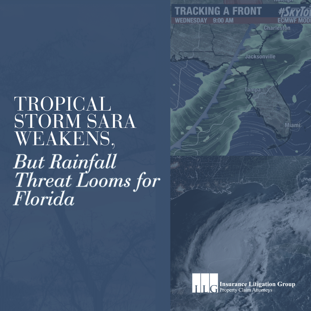
Now, the remnants of Sara are moving north into the Gulf of Mexico, where they are expected to merge with a cold front and bring widespread rain to the Southeastern United States. The heaviest rainfall will occur along the northern Gulf Coast, from Louisiana to the Florida Panhandle, on Tuesday and Wednesday, with some areas seeing up to 5 inches of rain. For Florida, the rainfall timeline begins Wednesday morning, particularly in the Tampa Bay area, with showers continuing through the afternoon before cooler, drier air moves in late Wednesday.
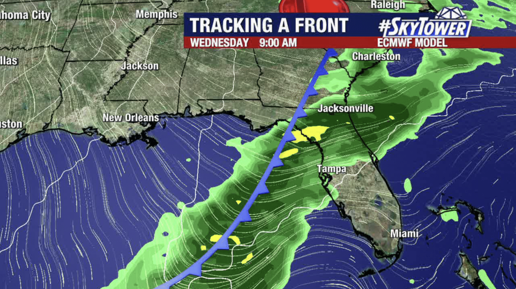
Remnants of Sara will move through Florida on Wednesday, bringing rain ahead of another cold front – Source: FOX 13
November Hurricanes
While Sara ultimately didn’t reach hurricane status, its formation in November highlights the rarity of tropical cyclones this late in the season. Historically, only three hurricanes have made U.S. landfall in November, with the last being Hurricane Kate in 1985.
This season has already been one of the most active and destructive in recent history, with 11 hurricanes — five of them considered major storms reaching Category 3 or higher. Sara’s potential to impact Florida as a tropical system has now diminished, but its remnants serve as a reminder of this year’s supercharged hurricane activity.
How Insurance Litigation Group Can Help
Even as Sara transitions from a tropical storm, heavy rainfall could still lead to localized flooding and property damage in parts of Florida. If you find your property affected by storm-related damage, Insurance Litigation Group (ILG) is ready to assist you. Navigating hurricane damage claims can be overwhelming, especially in the wake of a devastating storm season. ILG has a team of experienced Florida property claim attorneys and former public adjusters who are dedicated to helping residents, business owners, and property managers with expert guidance on insurance claims to maximize their insurance recovery.
ILG’s Services Include:
- Property Inspection: We offer free property inspections to help identify visible and hidden storm-related damages.
- Comprehensive Claim Preparation: Our team can assist in preparing and submitting your insurance claim to ensure accurate documentation of damages.
- Insurance Company Negotiation: Let us manage communications with your insurance provider, allowing you to focus on recovery.
- Expert Advocacy: If you have an underpaid or denied insurance claim, ILG’s experienced attorneys will advocate on your behalf for the full compensation you deserve.
With ILG’s help, you can navigate the complex insurance process with confidence. Our team has already helped Florida clients recover millions in hurricane claims, and we are here to support you.
Stay Prepared and Informed
With the remnants of Tropical Storm Sara poised to bring heavy rainfall to parts of Florida this week, residents should stay updated on weather reports and be prepared for localized flooding. Ensure your emergency supplies are stocked, and review your insurance policies for coverage details.
If your property sustains damage from storm-related events, call 888-ILG-4254 (1-888-454-4254) for a free property inspection and claim evaluation. At ILG, we are dedicated to helping you recover and rebuild.
